The balmy weather continued, but all around me there was evidence of the recent floods. Parts of the New South Wales North Coast had received their heaviest rainfall in forty years just over a week before.
 |
| Flooded paperbark swamp near Crescent Head |
I left Crescent Head on rural backroads across a wide floodplain. This is beef cattle and dairy country, but a fair proportion of it looked more like a vast network of streams and lakes. To the tourist it might be quite a pretty sight, but the locals were obviously doing it tough. As I ambled along the flat, narrow roads towards the Pacific Highway, I was basking in the sun and daydreaming a little (as you do), and not paying much attention to my surroundings, when I rode past a makeshift fence along a creek bank where someone had penned half a dozen calves.
 |
| Rivers and creeks across Northern New South Wales are still swollen, a fortnight after the floods |
For some reason, as I passed, the sight of me spooked the calves and they started running madly up and down their pen, until one of them leapt up and burst through the wire on to the road right in front of me. I stopped and looked on helplessly, feeling somehow responsible, as it galloped off down the road,. There was no-one around to alert - no house, no farm buildings, nothing. All I could do was ride on, in the same direction the calf had run. About half a kilometre down the road I passed the calf, which was calmly standing by the roadside and had completely forgotten that a man on a bike dressed in bright orange was a scary sight. A few hundred metres further, I was able to tell a neighbour of the owner of the livestock what had happened. He laughed at my concern. “Happens all the time”, he said. “Silly bastard should learn to build proper fences”.
Later that morning, I came across a man using a pitchfork to pull flood debris - mostly grass and branches - off a partly collapsed wire fence. Judging by the length of damaged fence, he had several days work ahead of him. He was covered from head to foot, including his face, and I wondered why. I stopped for a chat. Mistake!
The reason for his strange garb was that a lot of the debris was toxic: all the septic tanks and sewerage ponds in the area had been washed out by the floods, and the effluent had spread across the fields. He had already had infected wounds from contact with the debris, and was on antibiotics. It turned out that he owned all the surrounding land as far as the eye could see, and he was NOT a happy man. I stood for twenty minutes while he fulminated against the weather, the corruption of the local council, the insurance industry, the government ..... the entire world was conspiring against him. I extracted myself and left before it all became my fault.
A thirty kilometre stretch on the wide and smooth Pacific Highway brought me to Coff’s Harbour. On one fairly benign-looking bend near Urunga, I spotted a roadside memorial to a deceased truck driver. These little shrines are everywhere on the Pacific Highway, and indeed you'll find them on most Australian rural roads. The usual format is a cross inscribed with a name and dates of birth and death, perhaps a photo of the deceased, a bit of sentimental "in memoriam" doggerel, and a tacky wreath of plastic flowers. Sometimes the bereaved leave little offerings, like bottles of beer - the very things that are likely to have contributed to the tragedy.
However tasteless they are though, these memorials provide a useful reminder of the fact that the most dangerous thing we Australians ever do is not walking through bushland that's crawling with snakes, or swimming in shark-infested waters: it's getting into our cars and driving out on to the highway. This particular memorial was a little different from most in its incorporation of what were, presumably, parts of the dead driver's truck. I leave the evaluation of its aesthetic taste to you.
Like Port Macquarie, Coffs Harbour used to be an attractive place on a pristine bit of coast: now it’s an overcrowded jumble of shopping malls and carparks. I detoured on to the Coramba Road and climbed into the hills to the west of town, still clothed with banana plantations as they were when I first came here forty years ago. I sweated and strained as I hauled the bike up the mountainside but I couldn’t stop smiling. It felt good to be back in the sub-tropics.
I stopped for a beer at the Coramba Pub, feeling deserving and morally superior, as you do when you’ve just pedalled a heavily loaded bike up a mountain on a warm day.
Thirty warm, undulating kilometres later, I rolled into the attractive rural village of Glenreagh where, after another another mandatory beer at the local - the Golden Dog Hotel - I sought out the Recreation Reserve and Showgrounds, paid the caretaker the princely sum of eight dollars, and set up my tent under cover in an open-sided wooden shed. This would prove to be a very fortuitous decision.
Later that morning, I came across a man using a pitchfork to pull flood debris - mostly grass and branches - off a partly collapsed wire fence. Judging by the length of damaged fence, he had several days work ahead of him. He was covered from head to foot, including his face, and I wondered why. I stopped for a chat. Mistake!
The reason for his strange garb was that a lot of the debris was toxic: all the septic tanks and sewerage ponds in the area had been washed out by the floods, and the effluent had spread across the fields. He had already had infected wounds from contact with the debris, and was on antibiotics. It turned out that he owned all the surrounding land as far as the eye could see, and he was NOT a happy man. I stood for twenty minutes while he fulminated against the weather, the corruption of the local council, the insurance industry, the government ..... the entire world was conspiring against him. I extracted myself and left before it all became my fault.
A thirty kilometre stretch on the wide and smooth Pacific Highway brought me to Coff’s Harbour. On one fairly benign-looking bend near Urunga, I spotted a roadside memorial to a deceased truck driver. These little shrines are everywhere on the Pacific Highway, and indeed you'll find them on most Australian rural roads. The usual format is a cross inscribed with a name and dates of birth and death, perhaps a photo of the deceased, a bit of sentimental "in memoriam" doggerel, and a tacky wreath of plastic flowers. Sometimes the bereaved leave little offerings, like bottles of beer - the very things that are likely to have contributed to the tragedy.
However tasteless they are though, these memorials provide a useful reminder of the fact that the most dangerous thing we Australians ever do is not walking through bushland that's crawling with snakes, or swimming in shark-infested waters: it's getting into our cars and driving out on to the highway. This particular memorial was a little different from most in its incorporation of what were, presumably, parts of the dead driver's truck. I leave the evaluation of its aesthetic taste to you.
 |
| Roadside memorial to "Mickey". |
 |
| Banana plantation on the Coramba Road. |
 |
| Bananas and sugar cane: I must be near home. |
 |
| My sheltered campsite at Glenreagh |
 |
| One of the Glenreagh locals |
A clear, cool night with brilliant stars made me feel quite affectionate towards Glenreagh, especially from my comfortable vantage point in the open-sided shed. I left the fly sheet off my tent and fell asleep gazing at the stars through the insect mesh. My affection was tested when I woke in the early hours to the realisation that the temperature had plummeted to near zero. I noticed that the stars were still clear and bright as I dragged the fly sheet over the tent, put on my thermals, two pairs of socks and beanie, and crawled back into my sleeping bag. I woke again at dawn, confused. It was still freezing, but that drumming sound on the iron roof - could it be rain? I dismissed the idea because the night had been so crystal clear, and dozed off again, only to wake an hour later to the unmistakable sound of heavy rain. I crawled out of the tent to see the whole recreation ground shrouded in mist and being lashed by a heavy shower.
As I packed up to leave, the rain eased to a light drizzle, but there was no doubt I’d have to put on my full waterproof kit for the day’s ride. I carry good waterproofs, right down to silicon rubber overshoes. (There’s nothing more miserable than wet, freezing feet.) The morning’s ride was quite comfortable despite regular downpours, and by lunchtime, as I coasted down the Gwydir Highway into Grafton, the sun was beginning to make an appearance.
 |
| If you can't find it here, you don't need it. |
Grafton is an enigma: a sprawling, unattractive town when you skirt it on the Pacific Highway, but a place of surprises when you enter it from another direction and ramble around a little. It’s a big, rural service centre for a beef cattle, dairying and sugar-growing region stretching from the Great Dividing Range to the coast. The town straddles the Clarence - largest of the North Coast rivers and once a major transport artery. In summer, the place is ablaze with the purple blossom of hundreds of Jacaranda trees, providing an excuse for an annual Jacaranda Festival. (Although the name Jacaranda has an Aboriginal ring to it, the tree is actually a South African import.)
Unlike the neighbouring seaside towns of Yamba, Iluka, Angourie and the string of beach villages stretching Southwards to Coffs Harbour, Grafton isn’t a tourist trap: it’s a working, rural service town, and I like it for that reason. It’s a real place - not a media creation. As I cycled through town, I stopped to photograph several lovely colonial houses. This drew me into conversation with a number of locals, all of them friendly and relaxed.
Unlike the neighbouring seaside towns of Yamba, Iluka, Angourie and the string of beach villages stretching Southwards to Coffs Harbour, Grafton isn’t a tourist trap: it’s a working, rural service town, and I like it for that reason. It’s a real place - not a media creation. As I cycled through town, I stopped to photograph several lovely colonial houses. This drew me into conversation with a number of locals, all of them friendly and relaxed.
 |
| There are plenty of colonial gems like this tucked away in Grafton's otherwise unlovely streets |
North of Grafton, the narrow Lawrence Road carried me past the hulking, heritage-listed Grafton Jail, and on through a watery realm of levee banks, ponds and billabongs full of waterbirds to Lawrence itself - a pretty village on the Clarence with a surprisingly large and well-appointed pub overlooking the river, where it would have been rude not to stop for a cleansing ale on an afternoon becoming sunnier and warmer by the hour.
 |
The "pick-a-plank" bridge into Lawrence. Some of the gaps between the planks on these bridges can swallow a bike wheel. |
Twenty pleasant kilometres later, I crossed the river again on the Bluff Point car ferry (no charge for bikes) and coasted into Maclean. This otherwise typical sugar town has crafted an identity for itself as Australia’s Scottish town.
 |
| The Bluff Point Ferry |
This seems a little misplaced in a subtropical place surrounded by canefields, but Maclean certainly was settled by Scots in the mid-nineteenth century, and their influence persists. In any case, the Scots are nothing if not adaptable. The tartan-painted power poles and other touristy knick-knacks are a little on the hokey side, but the town has a certain charm, with its twisty main street full of interesting shops, restaurants and pubs winding down to the river. The rain had returned, so I checked into an overpriced cabin in the Maclean Riverside Caravan Park (“No camping. No exceptions”) and anticipated a comfortable night with no need to pack up a wet tent in the morning.
 |
| Every main street power pole in Maclean is emblazoned with a clan tartan |
For some reason I didn’t sleep well in the ample double bed. Perhaps I’m just not used to beds anymore, and my skimpy little three-quarter-length Thermarest is my mattress of choice forever. In any case, I was up and packed and on my way by 7:00 am. In familiar territory now, and only 200 kilometres from home, I got myself into distance-covering mode and decided to ride to Ballina - 90 k’s north on the Pacific Highway.
It was a mixed day of rain, patches of sunshine, still periods punctuated by gusty South-Easterlies, and one way or another I found myself at my target destination by lunchtime. The obvious next destination was Byron Bay, only thirty kilometres further North, and within easy striking distance of Tweed Heads - my home base - the next day. I stopped for lunch, then pushed on, blessed by a tailwind and a reappearance of the sun.
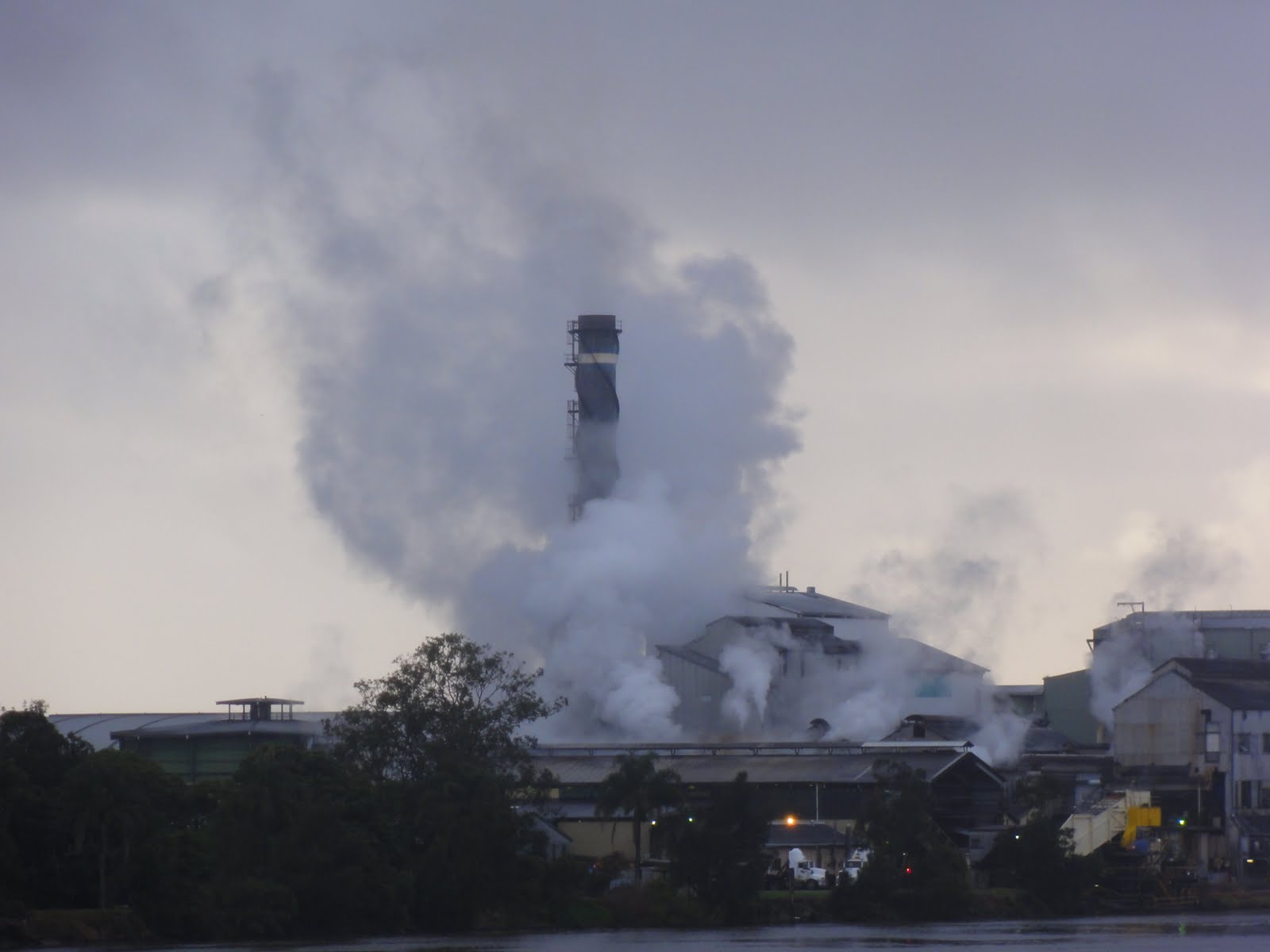 |
| The Harwood Sugar Mill is not actually exploding: it just looks that way. |
 |
The comfy-looking verandah of this cane farmer's house on the Richmond River South of Ballina looked out on .... |
 |
| ... this. |
By 4:00 pm I’d checked into a backpacker hostel in Byron, had a shower, and was wandering the streets of Australia’s “alternative” tourist capital and Easternmost point of the continent, having ridden 120 kilometres since 7:00 that morning.
 |
| Empire Vale is a tiny place, so rather than a Post Office, it has a Post Cupboard. |
The only other inhabitant of the eight-bed dormitory room at the hostel was Vai, a young, recently qualified doctor. Indian by birth, he’d grown up in Birmingham and completed his medical degree at York. He was having a brief holiday in Byron Bay before heading to Perth for a three week placement in a city hospital. He spoke of the possibility of working for Medecins sans Frontieres when he’d accumulated some experience. What a joy to talk to an idealistic, compassionate and clever young man intent on using his talents to do good in the world! He was also passionate about cricket, which raised him in my estimation even further. When I left, early the next morning, he was excited about going snorkelling with sea turtles that day.
 |
| Rainbow over the Cape Byron Lighthouse, taken from the balcony of Nomads Backpacker Hostel. |
I consider the whole Australian continent my home, and I've lived and worked in many parts of it, but the Tweed Valley is one of those parts that has become special to me. Suffering under heavy development pressures, it remains one of the environmental jewels of Australia. The backdrop of the Border Ranges, enclosing World Heritage Rainforests, and the distinctive spire of Wollumbin / Mount Warning, preside over a lush landscape of forested ridges, estuarine lakes, sugar cane fields, dairy farms and coastal heathlands. On the Pacific edge lie pristine surf beaches that are the equal of any on the planet. As I rode into this "Green Cauldron", it really felt like coming home.
 |
| Wollumbin / Mount Warning looms over the Tweed Valley. Its spire is a volcanic plug - the remains of magma that solidified in the crater, now eroded away, after its last eruption 20 million years ago. |
 |
| The magnificent Tweed coast |
 |
| Tweed Valley cane farms with the Border Ranges in the background |
No comments:
Post a Comment